The Clackamas Water Trail
Supporting Low Impact Recreation
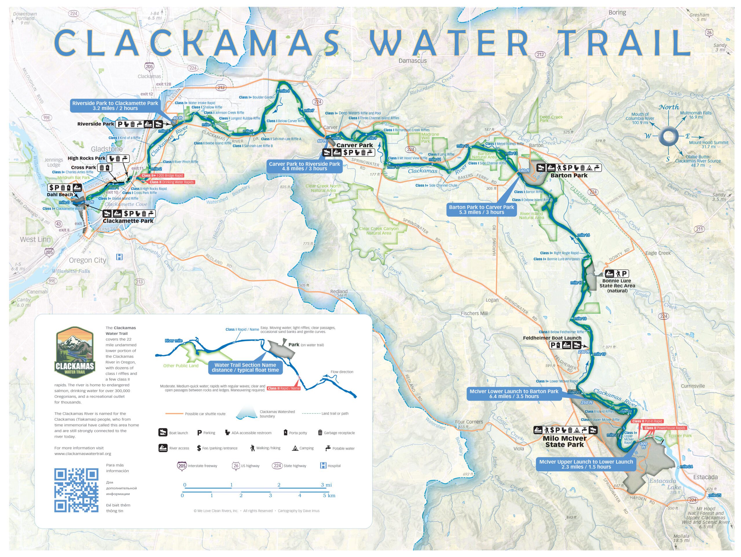
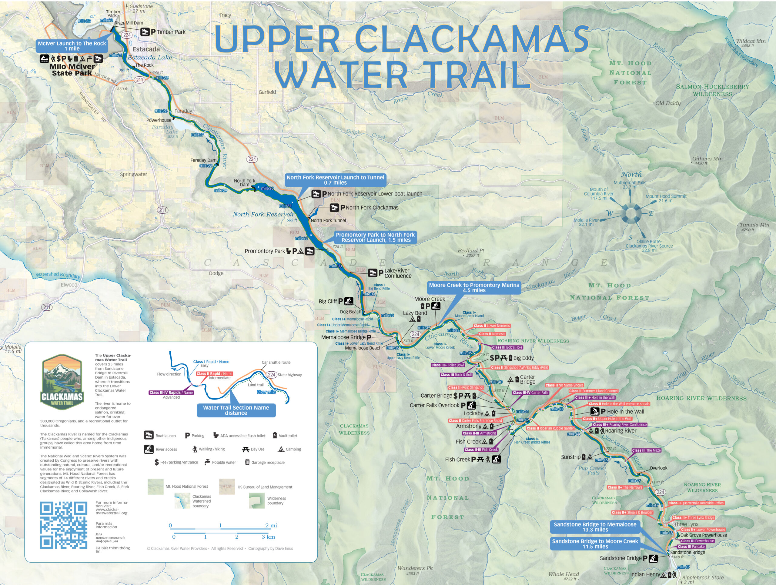
The Clackamas Water Trail encompasses the Clackamas river from Sandstone Bridge to confluence with the Willamette River, and offers an array of river recreation activities, protected habitats, and drinking water for over 300,000 people in the Portland metro area.
USGS Water Gauges
CLACKAMAS RIVER NEAR OREGON CITY, OR
- Temperature: 44.42° F
- Streamflow: 2370 ft³/s
- Gage height: 24.91 ft
CLACKAMAS RIVER AT ESTACADA, OR
- Temperature: 42.26° F
- Streamflow: 1940 ft³/s
- Gage height: 12.29 ft
CLACKAMAS RIVER ABOVE THREE LYNX CREEK, OR
- Temperature: 42.26° F
- Streamflow: 1530 ft³/s
- Gage height: 1.90 ft
LAND & WATER ACKNOWLEGEMENT CLACKAMAS PEOPLE
From time immemorial, the Chinookan tribes, referred to as the Clackamas People, have called this area home, and are still strongly connected to the river today. The Clackamas People caught year-round runs of salmon, steelhead, pacific lamprey, and built canoes and plankhouses from the wood of western red cedar trees that are found in the watershed. (language taken from CRBC 2015 Interpretative signs)
We PADDLE in it. We FISH in it. We PLAY in it. And sometimes… We just sit and LOOK at it.
I Drink the Clack
When you visit and enjoy the Clackamas River, please remember that it supplies drinking water to hundreds of thousands of people. By preserving the Clackamas River as a high quality drinking water source we can help minimize future drinking water treatment costs, while being good stewards of the river. Sustaining this precious resource is one of our top priorities.
The River is My Home


